
The network of driveable lanes is surprisingly large but many get forgotten and then quickly become lost when not driven regularly. Routes clearly labelled as 'Public Byway' understandably attract more off road traffic than those with no signs. Sadly greenlaners get a lot of bad publicity and this is often as a result of irresponsible drivers who have damaged land, fences and directly or indirectly caused death or injury to livestock. We've seen many a stone wall that has been demolished by a large vehicle sliding around in the mud and lots of places where drivers/riders have gone 'off piste' to enjoy more serious off roading. All this rightly angers the farmers and the footpath users and also the cyclists and the horseriders. As a result all vehicles end up being banned from the routes they are entitled to drive.
Some local authorities are more 'green lane friendly' than others, ensuring that routes are clearly marked as 'Byway open to all traffic' (BOATs) or, equally helpfully, as 'No vehicular access'. Even the 'Road unsuitable for motor vehicles' lets you know that access is allowed, you just need a suitable vehicle for the condition of the road.
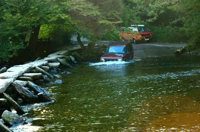
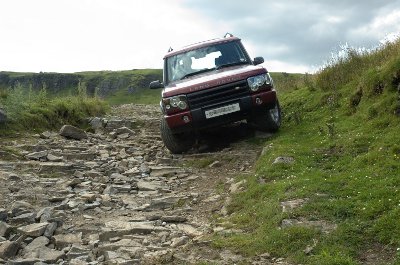
There are a few points to consider before driving even the most well marked of routes. All unsurfaced roads with access rights are public highways and therefore any vehicle using them must be taxed, insured and driven legally. Proceed with caution. What can start as a quiet grassy lane can suddenly turn into a deeply rutted nightmare that scrapes against the diff guards or suddenly becomes so narrow that you have no chance of avoiding scratched paintwork. Don't use the lanes if they are muddy. Not only do you risk damaging the lane and causing deep ruts but you also risk sliding off the track and damaging your vehicle or yourselves.
All the lanes shown on this site had vehicular access rights when we drove them. Some lanes were listed in Land Rover magazines and some we found by studying OS maps. We have included photographs and rough directions but you will need the listed OS Landranger map in order to locate the lane accurately.
© 2011
e-mail: contact@freetalk.me.uk
